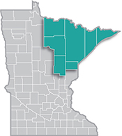
 Home to the state's second-largest metro, the Northeast Region has a strong industrial sector, tied largely to the area's abundant natural resources.
Most of the manufacturing base centers on mining and forest products industries. More than half of the sector's employment is in paper and machinery manufacturing.
Want the freshest data delivered by email? Subscribe to our regional newsletters.
12/19/2023 9:00:00 AM
Carson Gorecki
The recent data release for the U.S. Census Bureau's OnTheMap program is just the excuse I was looking for to highlight its unique data and useful insights. OnTheMap is an application that allows users to compare and contrast where workers live and work for detailed geographies down to the census block level. Users can create custom geographies for analysis as well as view statistics on worker age, race & ethnicity, industry, earnings, sex, and educational attainment.
Personally, I use OnTheMap a lot. One of my more common uses of OnTheMap is for an analysis of a commuting region. For example, if a business owner in downtown Hibbing wants to know what a reasonable radius is for recruiting potential employees, OnTheMap has a function that breaks down workers in a defined area both by distance of commute as well as direction. In the Hibbing employer example, there were an estimated 3,468 jobs in the Hibbing selection area around downtown. Of the workers in those jobs, 57% lived within 10 miles of their place of work, but more than 15% lived more than 50 miles away (see Figure 1). This does not mean necessarily that all 529 of those people are driving more than 100 miles every day for work – although many likely are - as telework options have increased over the past several years and could reflect remote workers.

OnTheMap provides additional information to further identify these likely commuters. The Home Destination Analysis option shows where workers live, from the state level all the way down to zip code tabulation areas, census tracts, and even school districts. Of the nearly 3,500 workers employed in Hibbing, 47% also call the city home, while the next largest share (6.4%) lives next door in Chisholm (see Figure 2). While most of the top ten cities of origin are located on the Iron Range, Duluth sticks out as accounting for the home residence of 120 of workers with jobs in Hibbing. Whether or not those folks are making the 150-mile round trip commute cannot be confirmed with these data, but it is unlikely that they are making the trek five days a week. Using this information, the business owner may focus their marketing or advertising in a way to take advantage of where potential workers would most likely live in relation to their work location.

In one final example, say you are a developer interested in building some housing in an Iron Range city and you want to locate your building where there is a demonstrated need. One way to assess that need is to search for an imbalance between the number of jobs in a place and the number of people living there. OnTheMap has a feature called Inflow/Outflow Analysis that allows users to see how many people live outside an area but commute in for work versus how many people live there and commute out versus how many people both live and work in the area.
If there are significantly more people employed in an area and living outside compared to those living in the area and commuting out, you can deduce that there is a net inflow of jobs to that place. This may be more attractive to a developer looking for a location convenient to the highest density of jobs, while lowering the potential commute time of residents.
The City of Duluth is just such a place. In 2021, of the 56,252 jobs in the city, 62.2% were held by workers living outside its borders (see Figure 3). Up Highway 53, Virginia has an even higher commuter share, with 79.1% of jobs in the city held by people living outside city limits (see Figure 4). Partly, this has to do with the geography of the cities themselves. Virginia has several neighboring communities which workers can live in and the density of a city like Duluth may not be appealing for all. Nonetheless, OnTheMap can provide data useful socioeconomic insights for decisionmakers and the curious minded of all kinds.

Contact Carson Gorecki, Labor Market Analyst, at carson.gorecki@state.mn.us.
